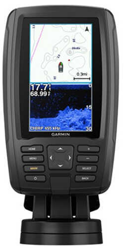
Garmin International ECHOMAP Plus 44cv with GT20 Transducer
Item #11397115MPN 010-01886-05UPC NOUPC520706
Garmin International ECHOMAP Plus 44cv with GT20 Transducer
The Garmin® ECHOMAP™ Plus 44cv GPS Fishfinder/Chartplotter Combo with GT20 Transducer and BlueChart® g3 Charts delivers a great upgrade or addition for any fishing or boating trip, thanks to class-leading performance. This compact powerhouse Garmin fish finder sports a crisp, 4.3" display and includes a transducer for Garmin CHIRP traditional sonar and CHIRP ClearVü scanning sonar. It comes preloaded with BlueChart g3 charts covering the coastal U.S. Plus, it has Quickdraw Contours mapping software that instantly creates personalized fishing charts on-screen with 1" contours, live, as you fish. You own these charts; they're yours to keep private to retrace to that hot spot or share with the Garmin Quickdraw™ Community on Garmin Connect™. Plus, you can share waypoints and routes with other ECHOMAP or STRIKER™ devices. The quick-release mount makes the Garmin ECHOMAP Plus 44cv GPS Fishfinder/Chartplotter Combo with GT20 Transducer and BlueChart g3 Charts easy to remove and take with you. Includes mount for transom or trolling motor.
Features :
- Bright, sunlight-readable 4.3" display
- Support for ultra-clear Garmin CHIRP traditional sonar for remarkable target separation; and CHIRP ClearVü scanning sonar for nearly photographic images of what's below the boat
- Preloaded with BlueChart g3 charts that cover the coastal U.S. (east coast, west coast, Gulf of Mexico, U.S., and the Canadian side of the Great Lakes)
- Built-in Quickdraw Contours live mapping software
- Share waypoints and routes with other ECHOMAP™ or STRIKER™ devices
- Quick-release mount for fast and easy mobility
Package Includes :
- CHOMAP Plus 44cv with BlueChart g3 for U.S.
- GT20-TM Transducer
- Power/Data Cable
- Tilt/Swivel Mount with Quick Rlease Cradle
- Flush Mount
- Protective Cover
- Hardware
- Documentation
Specifications :
General :
- Dimensions: 6 1/2" x 4" x 3.10"
- Display Size: 2.10" x 3.70" and 4.30" Diagonal
- Display Resolution 480 x 272 Pixels
- Display Type: WQVGA Display
- Weight: 1.60 lbs
- Water Rating: IPX7
- Power Consumption: 5W
- Antenna: Internal or External Over NMEA 0183
- Mounting Options: Bail or Flush
- Receiver: 5 Hz
- Garmin Marine Network Ports: None
Maps & Memory:
- Preloaded Maps: BlueChart g3 (Coastal Maps)
- Accepts Data Cards: 1 microSD Card (32GB Maximum)
- Waypoints: 5,000
- Routes: 100
- Track Log: 50,000 Points and 50 Saved Tracks
Outdoor Recreation Features :
- Tide Tables
Chartplotter Features:
- Garmin Sonar Compatible
- Supports AIS (Tracks Target Ships Position)
- Supports DSC (Displays Position Data From DSC-Capable VHF Radio)
Sonar Features and Specifications :
- Dual Frequency (50/200 kHz) Sonar Capable
- Dual Beam (77/200 kHz) Sonar Capable
- Transmit Power: 500 W (RMS) / 4,000 W (Peak to Peak)
- CHIRP Sonar Technology: Yes (Built-In)
- ClearVü: Yes with CHIRP (Built-In)
- Side
No reviews yet
Be the first to review this item.
Shipping
Enter your ZIP code for an exact shipping cost on this item.
Hazardous-materials fees, where they apply, are included in the total shown.